


You may also like
-
Antique map of Italy Poster
Institute of Liepzig · 1887 · Classic Italy map poster with crisp borders, islands, and dense geographic labeling
Poster from €9 · Framed from €16
Regular price From €6,00Regular price -
Antique map of Scandinavia Poster
Institute of Liepzig · 1867 · Detailed Scandinavia vintage print with pastel regions, blue seas, and dense cartographic labeling
Poster from €9 · Framed from €16
Regular price From €6,00Regular price -
Antique map of Brasil Poster
Institute of Leipzig · 1886 · Detailed Brasil vintage print with crisp borders and period German typography
Poster from €9 · Framed from €16
Regular price From €6,00Regular price -
Antique map of Mexico Poster
Institute of Liepzig · 1887 · Detailed Mexico vintage print featuring crisp borders and classic atlas typography
Poster from €9 · Framed from €16
Regular price From €6,00Regular price


-

"Very nice Posters. The quality is amazing and we received it very quickly !"
-

"A shop to visit absolutely. Huge selection of posters. We spent more than an hour there !"
-

"Perfect to find gift. Price are very good. An they can frame and pack it on site"


About the Artist
The Institute of Leipzig exemplifies the collaborative spirit of nineteenth-century European cartography, where geographers, engravers, and publishers worked together to produce authoritative maps. Leipzig, renowned for its vibrant book trade and publishing industry, played a pivotal role in distributing atlases and educational materials throughout Europe. This institutional approach ensured that maps were not only accurate but also widely accessible, shaping the way people understood the world.
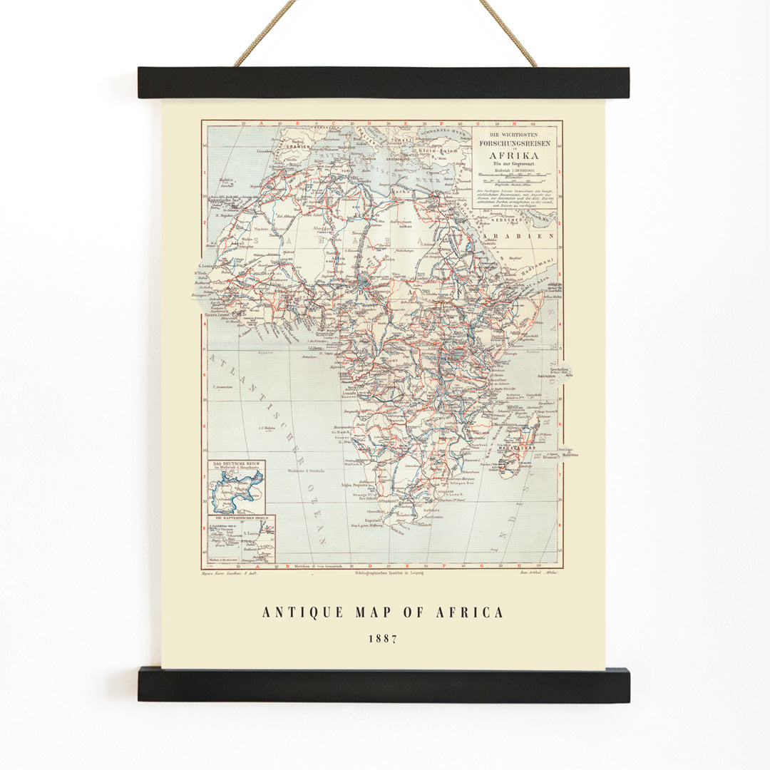
Maps produced in this context were often intended for both scholarly study and private enjoyment, bridging the gap between scientific inquiry and everyday curiosity. The 1851 map of Africa reflects this dual purpose, offering a window into the ambitions and worldview of its era.
The Artwork
Published in 1851, this vintage map of Africa emerged during a period when European interest in the continent was intensifying. The map synthesizes information from explorers, traders, and missionaries, providing a comprehensive visual reference for audiences eager to learn about distant lands. It served as a tool for education, debate, and the visualization of global knowledge at a time when much of Africa remained unmapped by Europeans.
Beyond its practical use, the map stands as a historical document, revealing both the extent and the limits of contemporary understanding. It invites viewers to consider how geography, exploration, and imagination intersected in the nineteenth century.
Style & Characteristics
This vintage print features a meticulously organized depiction of the African continent, framed by a grid of coordinates and surrounded by dense place names. The coastlines and borders are rendered with precise linework, while subtle touches of red and blue highlight key regions and divisions. The typography is crisp and orderly, reflecting the conventions of classic atlas plates.
The overall palette is restrained, lending the print a scholarly and contemplative atmosphere. Its detailed composition makes it especially appealing for those who appreciate historical maps and intricate design.
In Interior Design
This map print enhances spaces dedicated to study and reflection, such as home offices, libraries, or reading nooks. It complements vintage and classic interiors, and also adds character to minimalist settings seeking a meaningful focal point.
Pair it with dark woods, linen, or brass accents for a timeless look, or coordinate with navy and brick tones to echo the map's subtle color details. For more inspiration, browse vintage map wall art, discover ready-to-hang frames, or explore blue-toned prints for a cohesive display.