


You may also like
-
Plan of Barcelona and surroundings Poster
Unknown artist · 1890 · Barcelona map poster with sepia streets and coastal detail
Poster from €9 · Framed from €16
Regular price From €6,00Regular price -
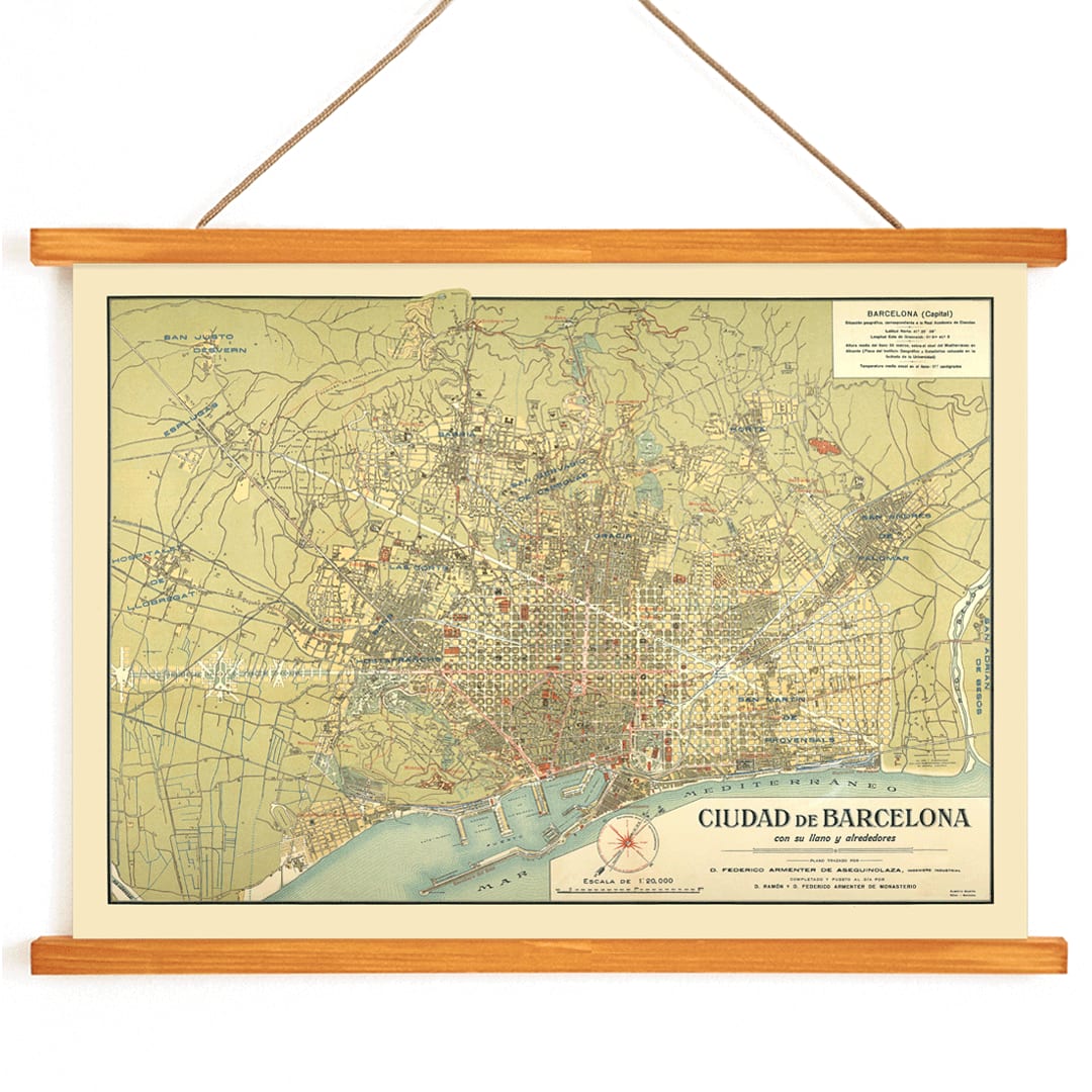
Plano de Barcelona 1870 Poster
Unknown artist · 1870 · Intricate Barcelona city plan vintage print with crisp street grid on warm beige
Poster from €9 · Framed from €16
Regular price From €6,00Regular price -
Barcelona satellite city map Poster
MORYARTY · 2026 · Barcelona satellite map poster with red district labels and coastline
Poster from €9 · Framed from €16
Regular price From €6,00Regular price -
Minimalist Map of Barcelona Poster
MORYARTY · 2018 · Minimalist Barcelona map poster with bold red street lines on warm beige
Poster from €9 · Framed from €16
Regular price From €6,00Regular price


-

"Very nice Posters. The quality is amazing and we received it very quickly !"
-

"A shop to visit absolutely. Huge selection of posters. We spent more than an hour there !"
-

"Perfect to find gift. Price are very good. An they can frame and pack it on site"


About the Artist
Created by an anonymous artist, this 1858 city plan is rooted in the rich tradition of nineteenth-century European cartography, a period when maps were both scientific documents and works of graphic design. These maps were typically the result of collaboration between surveyors, draftsmen, and engravers, reflecting the collective expertise of specialist workshops.
In mid-nineteenth-century Spain, detailed mapping projects were closely tied to urban development, infrastructure, and governance. This Barcelona map embodies the era’s drive for precision and civic pride, serving as a testament to the city’s evolving identity and the importance of accurate representation in public life.
The Artwork
This historical map of Barcelona presents the city just before its dramatic expansion beyond the medieval walls. The 1850s marked a turning point as Barcelona balanced industrial growth, trade, and urban planning. Maps like this were essential tools for officials and citizens navigating the city’s transformation.
The map is linked to the influential milieu of Spanish cartographers such as Francisco Coello and Antonio Sans, who contributed to the standardization of urban mapping. Today, it stands as both a valuable historical document and a window into Barcelona’s urban past, appealing to those interested in city history and cartographic heritage.
Style & Characteristics
The map features a meticulously organized street grid, with precise linework and clear typographic labels that convey information efficiently. The composition is framed with decorative borders, and the engraving technique imparts a refined, archival texture ideal for close examination.
The paper displays a warm beige tone, while subtle highlights in red, blue, and green distinguish key features such as streets, water, and boundaries. The overall effect is calm and scholarly, blending decorative appeal with the authority of a functional city map.
In Interior Design
This vintage Barcelona map print is well-suited for studies, hallways, or living spaces where a cultured and understated focal point is desired. It complements neutral palettes, wood, and leather, and adds structured interest to minimalist interiors.
To harmonize with the map’s palette, consider pairing it with linen or stone-colored furnishings and accenting with soft blue or muted red decor. Discover more city-inspired wall art in our maps collection, explore local themes in Barcelona posters, and find matching tones in beige wall art.