


You may also like
-
map of the British Isles Poster
Atlas of the World · 1900 · Detailed British Isles map poster with crisp borders and classic Edwardian typography
Poster from €9 · Framed from €16
Regular price From €6,00Regular price -
Iceland Political Map Poster
Samuel Eggertsson · 1890 · Detailed Iceland political map vintage print with hand-tinted regions and crisp coastal labels
Poster from €9 · Framed from €16
Regular price From €6,00Regular price -
Europe geology map Poster
John George Bartholomew · 1942 · Detailed poster of Europe’s geology with layered colors and fine cartographic linework
Poster from €9 · Framed from €16
Regular price From €6,00Regular price -
Ancient map of Spain Poster
Carl Diercke · 1905 · Detailed Iberian Peninsula vintage print with regional borders and coastal waters in soft beige and blue
Poster from €9 · Framed from €16
Regular price From €6,00Regular price


-

"Very nice Posters. The quality is amazing and we received it very quickly !"
-

"A shop to visit absolutely. Huge selection of posters. We spent more than an hour there !"
-

"Perfect to find gift. Price are very good. An they can frame and pack it on site"


About the Artist
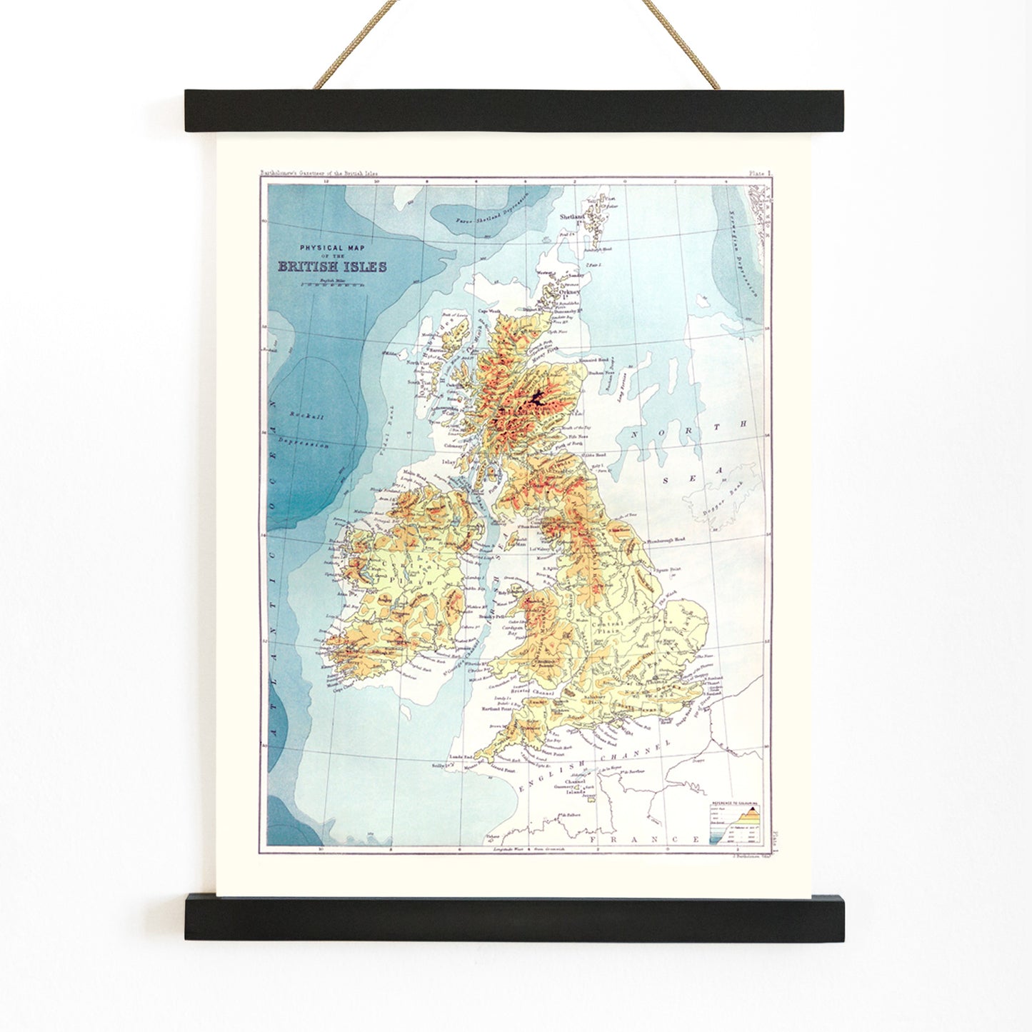
John Bartholomew was a renowned Scottish cartographer and publisher whose Edinburgh-based firm played a pivotal role in shaping British mapmaking during the late nineteenth century. His commitment to accuracy and clarity made his maps essential resources for both the public and professionals at a time when reliable geographic information was increasingly important.
This vintage British Isles map poster reflects an era when atlases, gazetteers, and classroom wall maps were central to how people visualized and navigated their world. For more geography-inspired wall art, explore our maps collection.
The Artwork
Created as a companion to a Victorian-era gazetteer, this 1887 map was designed to help readers quickly locate towns, counties, and significant landmarks across the British Isles. Such reference tools were vital for travel, commerce, education, and administration, especially as expanding railways and postal networks transformed daily life and mobility.
Today, the map serves as a historical snapshot, capturing how the British Isles were organized and understood in the Victorian imagination. It invites viewers to explore the past from their own space, offering a tangible link to the era's fascination with discovery and order.
Style & Characteristics
This print features a meticulously organized atlas layout, with fine linework and densely arranged place names that exemplify late nineteenth-century cartographic style. Coastlines and internal borders are rendered with careful precision, creating a harmonious and informative composition.
The color palette is understated, relying on subtle tones to emphasize clarity and structure rather than decorative flourish. The overall effect is scholarly and composed, making it a natural fit alongside blue tone wall art and other classic prints that reward attentive viewing.
In Interior Design
This British Isles map art print is well-suited to studies, hallways, living rooms, or library nooks where a sense of history and sophistication is desired. It complements traditional interiors, coastal themes, and modern spaces that incorporate vintage prints as focal points.
Pair it with warm neutrals, deep blues, reds, or wood finishes for a timeless look. For a refined presentation, consider our frames collection, especially in black, walnut, or light wood.