


You may also like
-
Ancient map of London Poster
Friedrich Arnold Brockhaus · 1899 · Detailed London map poster tracing the Thames and street grid in muted tones
Poster from €9 · Framed from €16
Regular price From €6,00Regular price -
Map of the city of New York Poster
Unknown artist · 1850 · Detailed New York City map vintage print with dense street grid and waterfront outlines
Poster from €9 · Framed from €16
Regular price From €6,00Regular price -
Eastern division of Paris Poster
James Shury · 1834 · Finely engraved Paris map poster with dense street detail and crisp black linework
Poster from €9 · Framed from €16
Regular price From €6,00Regular price -
Minimalist London Map Poster
MORYARTY · 2018 · Minimalist London map poster in crisp blue and white with landmark markers
Poster from €9 · Framed from €16
Regular price From €6,00Regular price


-

"Very nice Posters. The quality is amazing and we received it very quickly !"
-

"A shop to visit absolutely. Huge selection of posters. We spent more than an hour there !"
-

"Perfect to find gift. Price are very good. An they can frame and pack it on site"


About the Artist
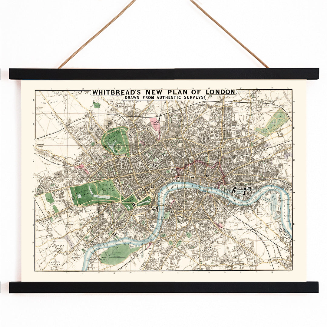
J. Whitbread is credited as the maker of this 1853 street plan, created during a period when London was rapidly transforming under the pressures of industrialization and urban growth. The Victorian era saw a surge in commercial mapmaking, as city dwellers and newcomers alike needed reliable guides to navigate the expanding metropolis. Whitbread's work reflects the era's emphasis on utility and precision, serving both practical and civic purposes.
Rather than offering an idealized vision, Whitbread produced a functional document that mirrored the needs of a city in flux. Today, this map stands as both a historical artifact and a testament to the graphic clarity valued by Victorian cartographers, making it a notable piece for those interested in maps and British urban history.
The Artwork
Whitbread's new plan of London captures the city at a pivotal moment, as new infrastructure and administrative boundaries began to shape daily life. The map was designed to address the practical requirements of commerce, travel, and governance in Victorian London, highlighting major routes and key institutions.
The clearly marked City boundary reflects the importance of identity and jurisdiction in a metropolis that was quickly outgrowing its medieval core. As a vintage print, it preserves a snapshot of London just before further waves of redevelopment, offering insight into how the city presented itself to those navigating its streets.
Style & Characteristics
The map is distinguished by its clarity and order: dense black lettering and architectural markings stand out against warm beige paper, evoking an archival atmosphere. Main thoroughfares are accentuated, while parks and open spaces are rendered in softer tones. The City boundary is outlined for emphasis, and the River Thames provides a dynamic visual anchor.
Fine linework, precise spacing, and consistent cartographic symbols lend the piece its Victorian authority. The restrained color palette and balanced composition contribute to its enduring elegance, making it an appealing choice for a beige-inspired interior or a curated gallery wall.
In Interior Design
This London map brings historical depth and visual structure to hallways, studies, or living rooms, rewarding close inspection with its intricate detail. It pairs well with classic interiors featuring dark woods and brass, but also complements minimalist spaces by adding a sense of order and heritage.
To echo the map's character, combine it with warm whites, slate blues, or muted greens in your decor. For a refined presentation, select a simple mat and a slim black or natural wood frame from our frames collection to highlight the cartographic artistry.